Zambia
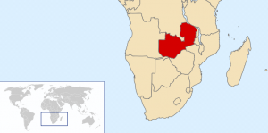
Zambia is located in southern Africa. It’s capital city is [[Lusaka]] where the majority of its population is located. The government is a Republic and the official language is English.
The area today occupied by Zambia was primarily inhabited by [[Khoisan]] hunter-gatherer tribes until roughly 300 AD. In the late 18th century, European explorers began to visit the area. The famous explorer [[David Livingstone]] was among them. Livingstone attempted to end the slave trade there through Christianity, commerce, and civilization.
Zambia is the size of 6.5 Pennsylvanias.
Locations

Mansa, Zambia
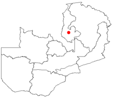
The capital of Zambia is Lusaka. The town John and Ruth live in is Mansa; this is where I will be staying. Mansa is the capitol of the [[Luapula Province]]. It has 42k+ people living in it.
During my trip, I also visited the villiages of Chipata and Mfuwe. They are both on the eastern part of the country.
Demographics
Almost 12 million people live in Zambia. The median age is 17 years and the life expectancy is 39 years — the third worst in the world, only better than Angola and Swaziland. There are 42 people per square mile — compare with St. Marys, PA which has 141 people per square mile.
Economy
Zambia is classified as a [[third world country]]. As of 2007, 65% of the population lives below the poverty line. As of 2000, 50% of its citizens were unemployed. The primary occupation is agriculture although copper mining was once popular; copper and cobalt continue to be Zambia’s number one export.
Climate
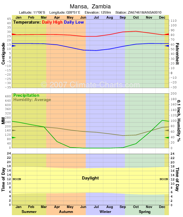
The climate of Zambia is considered tropical or subtropical. The year round temperature for Mansa is displayed on the graph below.

References
1. http://en.wikipedia.org/wiki/Zambia
2. http://www.climate-charts.com/Locations/z/ZA67461MANSA0010.php
3. http://en.wikipedia.org/wiki/Mansa,_Zambia
4. http://population.mongabay.com/population/zambia/907770/mansa

