Labeled synthetic aperture sonar, released as datasets.

Vision models learn a new kind of imagery from large collections of labeled examples, and for synthetic aperture sonar those collections have not existed. Survey imagery is expensive to collect, much of it cannot be shared, and labeling it takes a trained analyst for every object in every scene. A simulator that knows where every object sits can write the labels at the same time as the image, and that is what makes a labeled sonar corpus possible. The releases on this page are that corpus, produced end to end with ApertureLab and published on Hugging Face under one license.

They are meant for two kinds of reader. For machine learning they are detection and segmentation data with exact ground truth and fixed splits. For acoustics and seafloor research, every image ships with the scene file that produced it, so a swath can be regenerated, perturbed and compared against the terrain and the objects behind it; from version 1.1 the terrain itself ships as a height map beside the image.

Version 1.1

ApertureLab Synthetic SAS Dataset v1.1 Regenerating

Version 1.1 re-issues the thousand-swath release with the corrections the first one called for: labels that follow the terrain and the burial of each object, an image that carries its own georeference, and seafloors with metres of relief instead of centimetres. It is being regenerated with every object kind as its own label category, four target shapes and 23 kinds of clutter; a first render under an earlier scheme was withdrawn. The 20-swath pilot has rendered and the full batch of 1000 was restarted on the evening of 2026-09-23 so that every label file is written in the per-kind categories. The figures below are drawn from swaths of the first run, which rendered the same scenes with the same renderer.

The label categories are these:

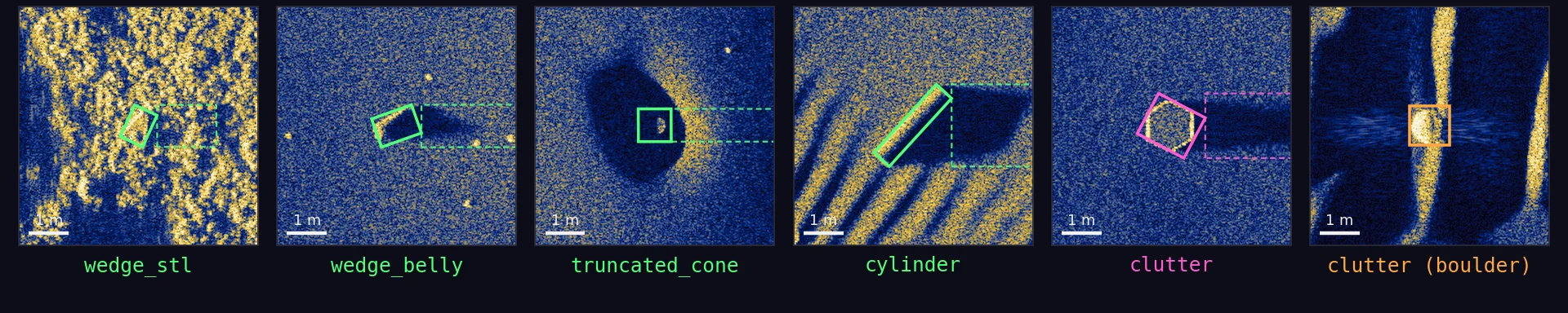
Six sonar chips in a row, each with its label polygon drawn and its category name below: wedge_stl, wedge_belly, truncated_cone, cylinder, a placed clutter object and a boulder (rock)
One example of each class6 m chips at the native 2.5 cm, each cropped around its COCO box with the footprint polygon drawn; clutter is shown twice, as a placed object and as a boulder
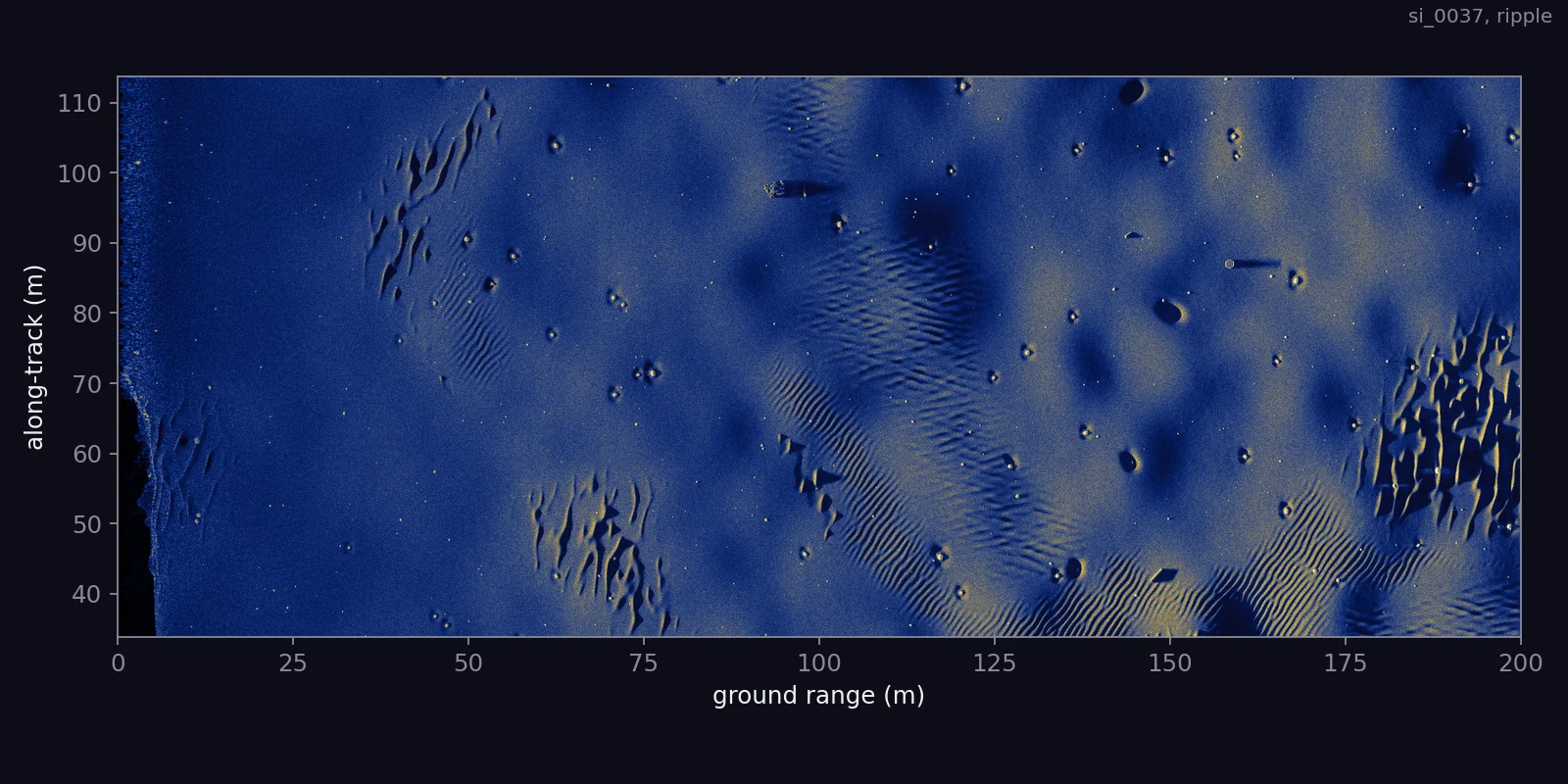
A whole v1.1 sonar swath of rippled sand, along-track up and range to the right
The imagea rippled sand scene; the palette GeoTIFF shown through its own palette, 200 m of ground range by 80 m along track, reduced from 8000 by 3200 px
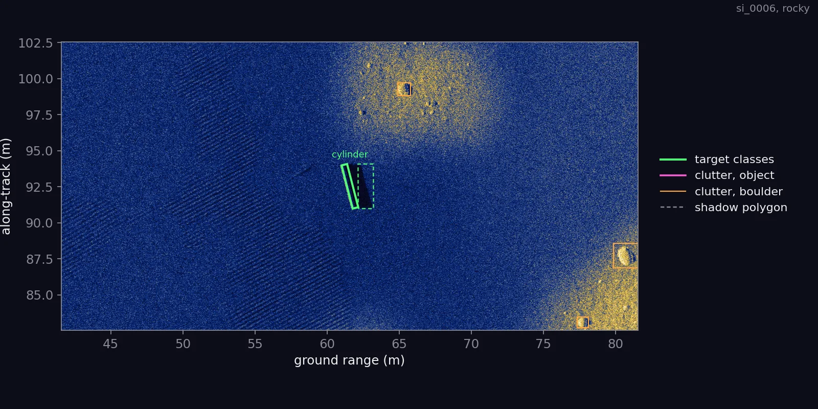
A 40 m by 20 m window of a rocky swath at full resolution with target, clutter and boulder polygons drawn
A window, labelled40 m by 20 m of a rocky scene at full resolution with its COCO file drawn: targets in green, clutter objects in magenta, boulders in orange, shadow polygons dashed
Instrument
A simulated HISAS 1030-class synthetic aperture sonar: 100 kHz centre frequency, 30 kHz of bandwidth, 32 receive channels; straight track, starboard side, altitude drawn per swath from 15 to 25 m.
Size
1000 swaths planned, split 800 train, 100 validation and 100 test; the scene plan holds 2000 targets, 500 of each target class, over 700 swaths and leaves 300 without targets. Counts of what has been labeled will be published with the finished card.
Image
8000 by 3200 px at 2.5 cm, covering 200 m of ground range by 80 m along track; an 8-bit palette GeoTIFF with no watermark.
Per swath
drc.tif image, coco.json labels and acquisition record, dem.png height map, rocks.csv boulder table, and the scene YAML.
Labels
27 COCO categories: four targets under the supercategory target, and rock plus 22 clutter shapes and meshes under clutter; id 28, clutter_other, is reserved for scenes outside the dataset and never occurs in it.
License
ALSD-1.0, the ApertureLab Synthetic SAS Dataset License.
Version 1.0

ApertureLab Synthetic SAS Dataset v1.0 Published

The first release: one thousand swaths over five seafloor families, with a cone and a wedge as the two target classes and a wide pool of clutter objects, each image labeled with COCO polygons and shipped with its scene file. It remains available as published, including its one known defect, an information box burned into the lower-right corner of every image.

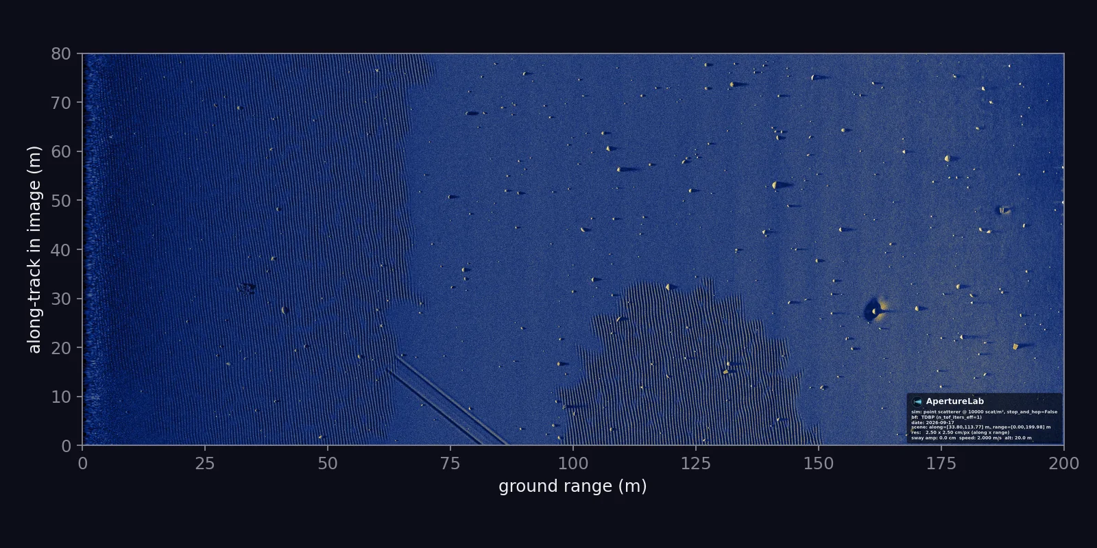
A whole v1.0 sonar swath of rippled sand with trawl scars, along-track up and range to the right
The imagescene si_0008, ripple fields on sand with trawl scars; reduced from 8000 by 3200 px; the information box sits in the lower-right corner
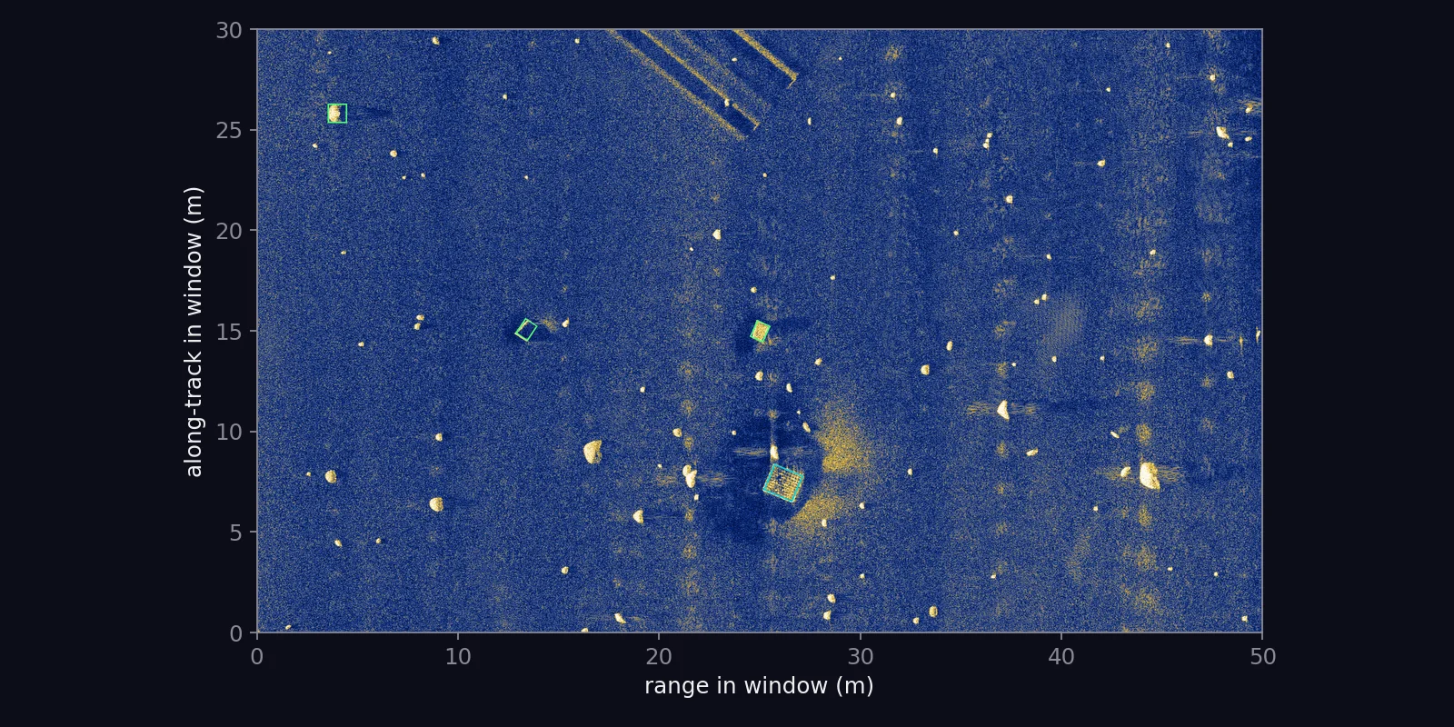
A 50 m by 30 m window of a v1.0 swath at full resolution with green target polygons and a cyan clutter polygon
A window, labelledscene si_0581, 50 m by 30 m at full resolution with its COCO polygons: targets in green, clutter in cyan
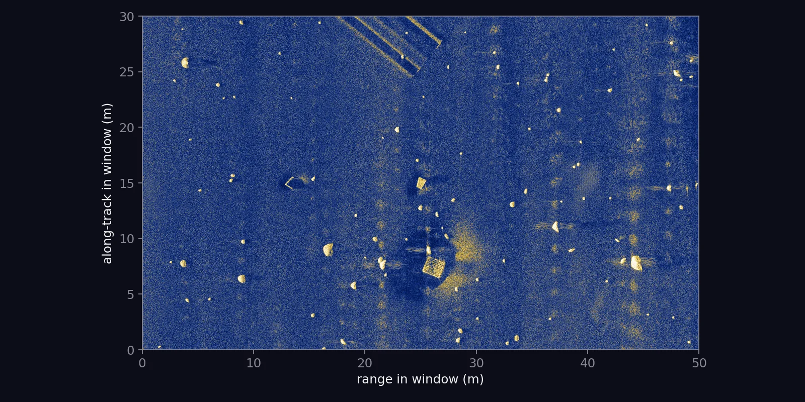
The same 50 m by 30 m window without labels
The same window, cleanwhat a detector sees: the window above without its labels
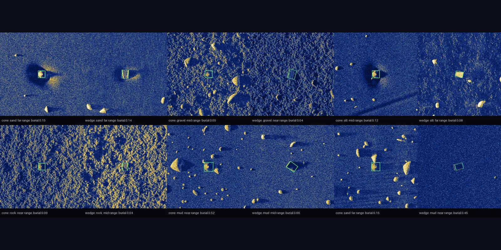
Twelve 10 m chips of cones and wedges on sand, gravel, silt, rock and mud, each with its green label polygon
Target chipsa cone and a wedge on each substrate, near and far range, exposed and buried; 10 m chips at the native 2.5 cm
Instrument
A simulated HISAS 1030-class synthetic aperture sonar: 100 kHz centre frequency, 30 kHz of bandwidth, 32 receive channels; straight track at 20 m altitude.
Size
1000 swaths, split 800 train, 100 validation and 100 test, about 40 GB of images; 2000 labeled targets and 2479 labeled clutter objects.
Image
8000 by 3200 px at 2.5 cm, covering 200 m of ground range by 80 m along track; RGB TIFF with LZW compression.
Per swath
drc.tif image, coco.json labels, and the scene YAML; manifest.csv, objects.csv and coco_all.json cover the whole set.
Labels
5503 COCO polygons in 27 categories: the two target classes, 22 clutter classes and three seafloor features.
License
ALSD-1.0, the ApertureLab Synthetic SAS Dataset License.
Next: how the labels are emitted, or how a seafloor is authored.